Radar data users in the Netherlands meet with MDA
On 2 May, NSO organized a workshop on the use of radar data in collaboration with data provider MDA. About 30 professional users from the government, knowledge institutions and industry gathered to share best practices, inspire each other and get a sneak peak of MDA's latest radar mission.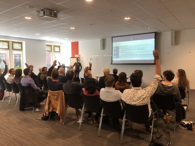
Mark Loos, project manager of the satellite data portal at NSO, starts with an inventory of the representatives from the government, industry and knowledge institutions.
Developments at data provider MDA
The satellite data portal was founded in 2012 by NSO. Through this portal, users from the Netherlands have free access to high-resolution optical satellite images and radar data. Since 2012, NSO has been purchasing Radarsat-2 images from the Canadian company MDA on behalf of the Dutch government. A long-term collaboration, in which a valuable archive of more than 10 years of radar data has been built up. Gordana Vujanic from MDA shared hopeful expectations for MDA's newest constellation, CHORUS, in a presentation. This mission will be launched in a few years and will deliver data of even higher quality. But until then, at least until May 2025, NSO will buy the Radarsat-2 images from the Netherlands. The high-resolution optical images can be viewed via www.satellietdataportaal.nl, and can be downloaded via an FTP server or via an API. The radar images are only accessible via the last two options. The use is free for users in the Netherlands, but users have to register first.
Applications of radar data
The fact that Radarsat-2 and other radar data such as Sentinel-1 from the Copernicus program serve various applications became apparent during the four presentations from various users that followed. Anneleen Oyen showed how Rijkswaterstaat uses information about changes in surface height derived from InSAR data, a specific application of radar data in which deformations can be accurately measured by analyzing the phase differences in signals from successive radar images. Looking back at radar images of the now closed A7 between Sneek and Joure, where the asphalt near the Princess Margriet Canal turned out to have been pushed up by the groundwater, this deformation was already visible at an early stage. Asset managers at Rijkswaterstaat are enthusiastic about this new source of information. However, this requires an extensive and complicated analysis, in which various market parties were also involved. Reda Meftahi of Survey Intelligence explains in his presentation why this analysis is complex. Although the InSAR technique in itself is complicated and requires specialist knowledge, this certainly also applies to the interpretation of the maps that are produced on the basis of InSAR analyses, is his message. Providing context is therefore of great importance for both professional users and the general public.
In addition to mapping subsidence, radar images also have another major advantage over optical images. With radar images you can see right through clouds, and you are therefore not dependent on the weather conditions. NLR's Job de Vries showed how, among other things, they use this property and improve their object detection by combining optical images, radar images and AI techniques. For example this is useful for monitoring of roads or to better characterize the flood plai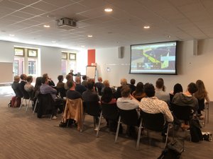
Gordana Vujanic, Manager at MDA, about the new CHORUS mission that will be launched in a few years.
ns.
Reinier Oost from Sensar showed how their latest development contributes to partly removing one of the disadvantages that are often mentioned about radar data. While optical images produce 'pretty' images that are relatively easy to interpret, the interpretation of radar data is generally less intuitive. By removing a large part of the noise on radar images with AI techniques, the radar images become easier to interpret. On the one hand this contributes to better object detection, for example changes in urban areas, and on the other hand this can lower the threshold for potential users.
Discussion
The end of the afternoon was marked by an interactive discussion. Because although valuable applications are being developed based on radar images, the use of this data seems to lag behind compared to optical images. The first statement therefore was: ‘The uptake of radar data and its products in the Netherlands is lacking behind compared to the use of optical high resolution data’. Certainly not everyone agreed, and the quick conclusion is that the applications cannot be compared 1-on-1, and it depends on the organization and sector to what extent a certain type of data is moving towards 'mature' use.
Various propositions and useful discussions followed, rounding off the inspiring afternoon with a drink and the call from many attendants to make this meeting with government, business and knowledge institutions a first step towards more cooperation and coordination, in order to increase awareness of radar data and even better use of this data with potential for many useful applications.