Jeroen Waanders (WDOD): 'The potential of satellite data for water authorities is enormous'
Satellite data of increasingly high quality are taking work out of the hands of water authorities. So says Jeroen Waanders, advisor Innovation at the Drents Overijsselse Delta Water Authority (WDOD). Waanders is a man with a mission. He believes water management in the Netherlands can be handled more efficiently and better with the help of data from space.
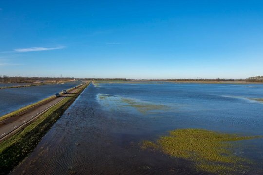
Dutch water authorities manage 350,000 kilometres of waterways. How does that work?
“Most water authorities use aerial photographs to assess the state of the area once per year, while the condition of ditches is inspected by deploying hordes of inspectors in the field. Farmers are partially responsible for maintaining these waterways, but the water authorities have to make sure this maintenance is actually being carried out. In the past, these inspections took us a week to carry out and 1.5 man years’ worth of capacity. Since 2019, however, we have been doing things very differently...”
What changed for your water authority at that time?
“Our inspection workload doubled after a merger. We did not get any extra people, though. That was when we began looking for alternative methods. That ultimately led us to the Satellite Data Portal. We used satellite images and machine learning to inspect ditches. As in previous years, 93% of ‘our’ ditches were in fine condition. There was no reason to send out any inspectors to these locations. This meant all our inspectors could immediately go to the areas where there were problems.”
What can you see on the satellite images you get from the data portal?
“They show the same area we manage on a daily basis, only from an entirely different perspective. When an inspector is out in the field, their vision is limited to the fifty to one hundred metres in front of them. If they want to know what lies beyond, they will have to walk or cycle over there. Satellite images show us exactly what condition the ditches are in. Whether there are any ongoing construction activities in the area. Whether ditches have been filled in. Whether there is any vegetation. The most recent satellite data even allow us to determine what type of vegetation grows in the ditch. The quality keeps getting better all the time.”
Does that increase in the quality of satellite imagery present any new possibilities for water authorities?
“Satellites have been used for some time to e.g. monitor soil moisture. With the increasing resolution, they can now also be used for operational tasks. Together with the Waterschapshuis, Rijkswaterstaat and STOWA and an SBIR subsidy from NSO, we are currently looking for ways to put satellites to even better use for water management purposes.”
Can you give us an example?
“For the NL Change Detection programme, we are looking at fifteen different user cases that we want to be able to detect. These range from vegetation around dykes and the use of chemical pesticides to an inventory of artworks and possible modifications of the landscape. The potential of satellite data for water authorities is enormous.”
How important is it for the government to take the lead in this development?
“Subsidies are a wonderful instrument to promote the use of satellite data. In truth, the Satellite Data Portal has become an essential tool for the management of public space. Our goal for the NL Change Detection programme is to develop an algorithm that can automatically detect changes in the landscape using the latest satellite images. That will result in a national information service that all supervisory bodies in the Netherlands can utilise.”
Your water authority was the first to use satellite images for the purpose of supervision. Do you expect other water authorities to follow suit?
“Satellite data are not a particularly well-known resource at the moment. It is high technology out in space. What can you do with that? How does it work? There are so many questions right now. The interest is certainly there, though. Other water authorities are visiting us to see how we do things, or I go to them to give a presentation. I show them how much more information you can get from satellite images.”
What do you expect your job to look like in ten years’ time?
“Who knows, we might have a swarm of nanosatellites specifically designed to perform tasks for the water authorities. Who can tell? In any case, inspectors will monitor their region from more perspectives than ground level alone. It starts with satellite images, which you can use to detect potential issues. You then move on to aerial photos or you could decide to send out a drone to capture the images you need. The final step is to send an inspector into the field.”
Does that still happen? Inspectors do not have to fear for their jobs?
“I firmly believe that inspectors are here to stay. In fact, things will only get better for them. All the preliminary selections, the menial tasks, the fruitless inspections; satellites will take care of all that for them. We only send our inspectors to places where there is very likely a problem. Places where they can use their many talents to resolve situations. Because they only have to go where they are really needed, they will have more time to do the job they are good at - and do it right.”