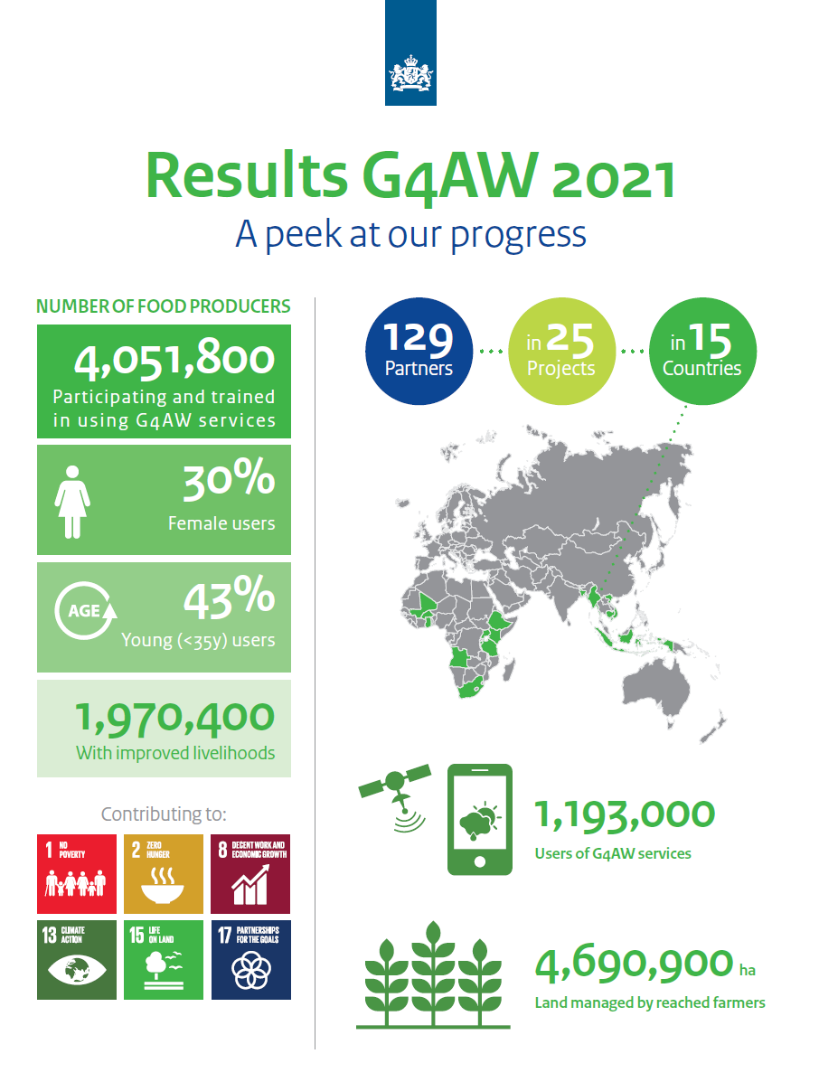
G4AW reaches 4 million farmers
The Geodata for Agriculture and Water (G4AW) programme is a grant programme implemented by the Netherlands Space Office (NSO) for the Netherlands Ministry of Foreign Affairs that focuses on improving food security and water management. With this programme, the NSO promotes the development of satellite- and geodata based services that strengthen food production and the livelihoods of smallholder food producers in developing countries. After eight years, the programme has reached 4 million food producers through 25 projects in Africa and Asia, a milestone that also contributes to several of the Sustainable Development Goals (SDGs).
Results
The SMARTseeds and SpiceUp projects provided agricultural advice to small-scale farmers in Indonesia through more than 66,000 subscriptions, and in Bangladesh the GEOPOTATO project has improved potato production for more than 323,000 potato producers. Furthermore, SUM-Africa ensured that farmers in Mali and Uganda were able to use index insurance for the first time thanks to satellite data, which resulted in nearly 134,000 policies and thus strengthened the resilience of small-scale farmers to climate change.
Whereas in 2018, 550,000 food producers were already reached by the G4AW services, this number expanded to 4 million users by 2021. Hereby the programme will improve the livelihoods of about 1.9 million people. See the infographic below for an overview of the latest results achieved by the G4AW programme and check the results page on the G4AW website to download this infographic.