EuroGEO Workshop: Collaborating to maximize the use of satellite data for our society
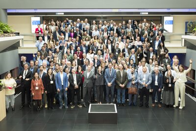
More than 250 professionals from the world of Earth observation gathered in The Hague this week for the three-day EuroGEO Workshop 2025. On the final day, the spotlight was on GEO Netherlands, a new national network that promotes innovation and collaboration in Earth observation across the Netherlands.
They may be invisible, but they’re incredibly important: the hundreds of Earth observation satellites orbiting our planet day and night. From space, they monitor air and water quality, soil subsidence, biodiversity, and much more. But how can we make the best possible use of the valuable data these satellites collect? That was the central question of the international EuroGEO Workshop 2025, held at the World Forum in The Hague and organised by the European Commission, EuroGEO, and the Netherlands Space Office (NSO).
“The real added value of space,” said NSO Director Harm van de Wetering in his presentation, “lies here on Earth. Satellite data can play a crucial role in areas such as soil and water management, food security, climate adaptation, safety, and other societal challenges we face together.”
Harm van de Wetering, director NSO.
In practice, however, it is not always easy to bridge the gap between (potential) users of satellite data and the providers developing specific satellite-based services. Governments too often miss opportunities to improve their daily work processes with the help of space-based solutions. The causes are many: from a lack of structural funding to legal barriers and limited awareness among potential users.
At the European level, EuroGEO promotes cooperation in Earth observation – among other things through the annual EuroGEO Workshop. Since this summer, there is also a Dutch counterpart: GEO Netherlands. The NSO hosts the secretariat of this network, which aims to close the gap between governments, businesses, and end users in the field of Earth observation. As Afke van Rijn, Director-General for Environment and International Affairs at the Ministry of Infrastructure and Water Management, explained: “By initiating and supporting GEO Netherlands together with the NSO, we are strengthening both national innovation and international cooperation to turn satellite data into societal solutions.”
A central role for the user
“In the Netherlands, there is a lot of innovation in the field of Earth observation,” said Coco Antonissen during one of the conference panel discussions. “But we want to move from research to operations. That’s why it’s important that governments, companies, and research institutes work together more closely, align with what’s happening in Europe and beyond, and put the end user at the centre.”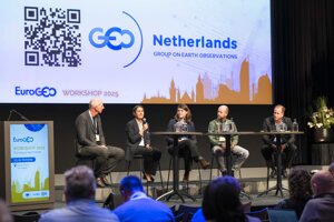
GEO Netherlands panel
The end user is the one applying satellite data to solve real-world problems. Dozens of inspiring examples were presented during the conference. Reinier Oost from the company Sensar explained how he used radar satellites to assess the impact of a new ring road in Groningen on nearby homes. Annelies Hommersom from WaterInsight showed how she monitors dredging activities and harmful algal blooms in the ocean from space. And Niek Hendriks from the municipality of Alkmaar demonstrated how satellite data on parking issues and other urban challenges are being used to rebuild citizens’ trust in local government.
“Combine, coordinate, cooperate” was the motto of the well-attended and successful EuroGEO Workshop. And that is exactly what the NSO will continue to do with GEO Netherlands, said Van de Wetering:“User acceptance is one of the strategic goals in the Long-Term Space Agenda. At NSO, we have a dedicated team of experts working on this specifically. GEO Netherlands offers an opportunity for all participants to collaborate more closely, so that as a society we can fully benefit from the opportunities space provides.”