Funding opportunities for innovative companies solving water problems with satellite data
How can we solve major water-related challenges using satellite data? And which companies will develop the technology needed for this? These questions were the focus of the matchmaking workshop PCP-WISE of last week Tuesday: better use of satellite data and technology for water management.
Worldwide, we face significant water-related challenges in the coming decades. Think of sudden floods, prolonged droughts, ground subsidence, risk of forest fires, and poor water quality. That is why Europe and the Netherlands are investing in innovative technology to tackle these challenges.
Through the PCP-WISE program, the European Union is looking for companies that can provide insights into the soil-water-vegetation system based on satellite data. In the Netherlands, the NSO challenges companies with the Innovation Impact Challenge Satellite Data for Biodiversity in the Netherlands: subtheme water. Two tenders, offering excellent funding opportunities for innovative companies.
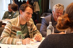
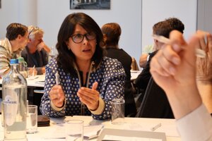
More than fifty people with diverse backgrounds attended the information workshop about both tenders. This diversity is exactly what the organizers, GeoBusiness Netherlands and the NSO, hoped for. Complex problems require a multidisciplinary approach from parties willing to collaborate in a consortium to find solutions.
Multidisciplinary
Participant Paula Golunska represents engineering firm Sweco. "At tenders like these, you might not immediately think of an engineering firm. But we have extensive knowledge in-house: geohydrologists, managers, biodiversity experts, environmental scientists, and remote sensing specialists. Additionally, we bring lots of knowledge about how the government operates, and we work internationally."
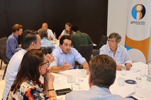 Together with other participants, Golunska brainstormed five concrete questions in the PCP WISE tender. One of those questions was brought in by the Municipality of Rotterdam. Eduard Schoor, climate adaptation advisor of that municipality, said: "Buildings in our city disrupt the soil-water-vegetation system. This makes the city more vulnerable to drought effects, vegetation is easier to damage, and during dry periods, we experience problems with water quality."
The municipality already collects much data but lacks high-resolution soil moisture measurements, data on evaporation and transpiration, heat islands, vegetation, and the urban water balance. A consortium of market parties via PCP WISE is expected to address this.
AI improves weather forecasts
The same consortium must also serve Helsinki, Haarlem, Bratislava, the Kalmthout Heath, and many other municipalities and regions. "The European tender PCP WISE is demand-driven," explains program manager Joost Buntsma. "It concerns challenges in both urban and rural areas. Five major issues, all at once. We’re not looking for a tool, because we cannot manage or further develop that. What we want is a kind of weather forecast, but specifically for the water-soil-vegetation system and for a longer term than just a few days ahead."
 That sounds good to Sem Vijverberg. He is part of the startup Beyond Weather, which uses artificial intelligence to make weather forecasts for specific areas and variables more reliable over the long term: "Sometimes we have a soaking wet spring and then a bone-dry one. Governments and water managers want to be able to anticipate that. Our application aims to help with that."
AI experts are definitely part of the solution, Buntsma thinks. According to him, water issues must be approached from various disciplines. This requires hydrologists, IT specialists, risk managers, legal experts, and data specialists. "Together, they develop the information we need to make Europe more resilient to climate change."
Endless possibilities of satellite data
Besides the European PCP WISE tender, the NSO stimulates innovation at the national level with the Innovation Impact Challenge, formerly known as SBIR. Winners of the innovation competition receive subsidies when they develop products or services using satellite data aimed at addressing a societal challenge—in this case, a challenge at the intersection of water and biodiversity.
 The possibilities of satellite data are endless, says Anneleen Oyen, advisor satellite applications at the NSO. From predicting severe droughts to mapping stress on agricultural crops and detecting blue-green algae to measuring subsidence of dikes, roads, and structures.
During the workshop, participants already brainstorm in changing groups about innovative ideas. In Amersfoort, for example, the foundation for future consortia is naturally being laid. These consortia can register for PCP WISE from September. The registration for the NSO innovation competition is already open, with a deadline of October 6 at 12.00.
More information
PCP WISE (EU)
Innovation Impact Challenge (NSO)