Dutch startup makes flying safer with satellite data
To make flying safer, Dutch startup Meandair developed a low-threshold application for pilots of small aircrafts. Courtesy of satellite data and courtesy of the NSO, which helped fund the development of the application through ESA's Business Applications Space Solutions program.
Meandair's application is as simple as it is effective: color codes on a digital map show pilots whether or not they can fly their desired route because of weather. Red: bad weather. Yellow: bad weather on the way. Green: good weather and adequate visibility. Behind the scenes, the data are updated every 15 minutes. And the weather forecast can be viewed up to five hours ahead.
"Many pilots in small aviation are currently working with the METAR," says Peter Novak. He is co-founder and director of Meandair. 'That's a brief and mainly very local, written weather report, which is only updated every hour or every two hours. 'We thought: that can be simpler and safer. So we started developing weather nowcasting for aviation: a personalized weather report for each pilot.'
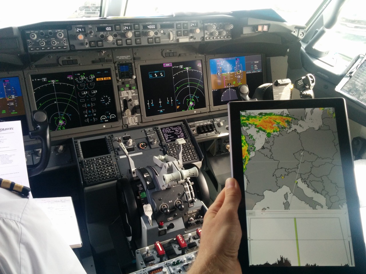
Testing of early prototype of Meandair's data in a tablet app on board of a Boeing 737 MAX in 2018.
Proven technology
Peter Novák and Antonín Komenda collaborated with KNMI and software company S[&]T, which has extensive experience in the Dutch space industry. This automatically brought the NSO into the picture, says Novák: "We received financial support twice. Once for our feasibility study in 2018 and once for developing a working prototype between 2020 and 2022 for our first customer SkyDemon.'
The NSO helped Meandair through the ESA Business Applications Space Solutions program. This program encourages companies that want to develop, improve and then market satellite applications. To do this successfully, a working prototype, i.e. proven technology, is very important.
Kathelijne Beenen of the NSO: 'We help companies develop applications that meet the needs of a launching customer, that have added value for society and that can be economically interesting. This can be in all sectors: in agriculture, energy transition, water management and, in this case, aviation.'
How important was this backing for Meandair? 'Incredibly important,' says Novák. 'We invested half ourselves and the other half came from the Dutch government through the ESA program. I dare say that without this subsidy, Meandair would not have gotten there. And now we are a Dutch startup, based in Delft, with seven people.'
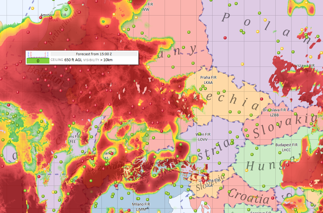
Screenshot of SkyDemon app with VFR Flyable Conditions
feature built on Meandair's data. Since 2021, SkyDemon is Meandair's
launching customer. Source: SkyDemon.
Airline pilots
There is no shortage of ambitions, at the still young aerospace company. In the coming years, it hopes to make the leap from small aviation to the glass cockpit: the dashboard of commercial pilots worldwide. So that KLM and other large airlines can also fly around bad weather and turbulence more easily. In addition, the company sees opportunities in energy transition. Novák: "We can process raw satellite data into a meaningful weather forecast within five to seven minutes. Such predictions are very important for wind and solar farms and renewable energy distribution networks.'
More information:
https://business.esa.int/projects/meandair
https://www.meandair.com/
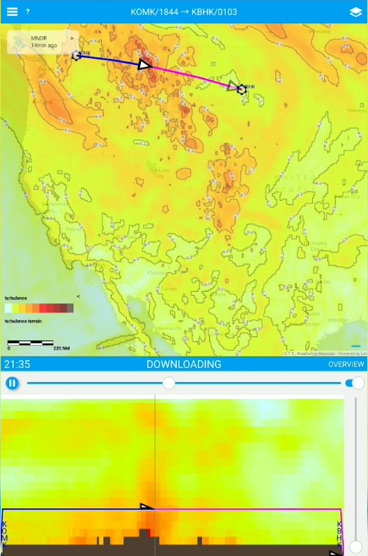
Meandair's Radair4D app providing an in-flight view on
turbulence conditions along the flight plan. Source: Meandair