Knowledge competition for good land and water use in Africa with innovative satellite applications
Developed countries are making full use of freely available satellite data for agriculture and water management. But how do you ensure that this data also reaches food producers and intermediaries in developing countries? Six Dutch companies are going to investigate as part of the NSO's Open Geodata Knowledge Competition.
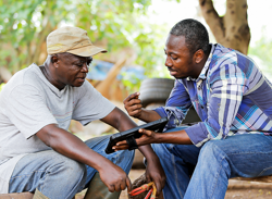
Image: FarmGrow, Rainforest Alliance
The knowledge competition builds on the success of the already existing Geodata for Agriculture and Water program (G4AW). This program has been demonstrating since 2013 that small farmers and entrepreneurs in developing countries can benefit from innovative satellite applications in their daily agricultural practice. But then those applications have to reach the farmers first.
There is still plenty of profit to be made here according to NSO. How? That should become clear from the experiences of the participants in the Open Geodata Knowledge Competition. Six companies received an assignment in March 2022 to gather knowledge about the deployment of their innovative solution for this challenge.
Mapworks is developing the Landscape Diagnostic Report for IDH, an organization that forges coalitions of companies, governments and NGOs to achieve sustainable production and trade. This annual landscape report provides accessible tools and insights for people with limited financial resources and without extensive knowledge of geoinformation systems.
eLEAF gives water and agricultural managers in Morocco access to easily usable indicators on water use, rainfall and vegetation. The information enables them to devise solutions to better distribute water and respond to increasing drought caused by climate change.
Together with SNV, Nelen&Schuurmans wants to develop a geodata-driven online information service called GeoLIS. Within GeoLIS, research is done on which information is essential in use cases on climate adaptation, water management, land use and agriculture. The focus area of the service is in the Laikipia-Isiolo-Samburu region in Kenya. The ambition is to develop an operational service with GeoLIS.
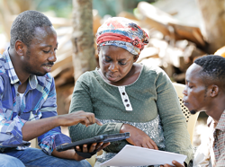
Image: FarmGrow, Rainforest Alliance
SarVision works together with the Tropenbos Institute and Congolese partners on an innovative method that detects and quantifies forest degradation on the basis of satellite data, even under the tree crowns. SarSentry will contribute to the sustainable production of cocoa by monitoring forested cocoa areas in Congo.
Resilience is developing SmartGrain for plantation owners in Mozambique. This application maps production areas and crop growth. This allows formal traders to reach more farmers, organize the purchase process more efficiently and at lower transaction costs. The application benefits maize farmers in Mozambique.
FutureWater is working with Holland Greentech on automated irrigation advice for small-scale food producers in Rwanda. For this purpose, it uses virtual weather stations that provide farmers with relevant information with which they can design their irrigation and improve the harvest.
The six feasibility studies will be judged by an expert jury in July. Up to three of the most promising applications will go through to the next round of the competition. The inventors of the application may develop and demonstrate a prototype. All entrants are required to share their experiences and insights with NSO. At the end of the second phase, NSO, supported by knowledge consultant Bopinc, will share the acquired knowledge in a publication.