Four ideas selected for development of satellite applications for strengthening biodiversity
Four Dutch consortia have been selected to investigate the feasibility of a new satellite application for the benefit of biodiversity on behalf of NSO. The winning companies and institutions participate in the SBIR innovation competition Satellite data for the benefit of Biodiversity in the Netherlands, theme: nature.
The Dutch government works together with nature organizations, scientists and the public to protect and promote biodiversity. In doing so, our country must comply with various international guidelines and treaties. But how do you investigate whether government policies actually restore or promote biodiversity?
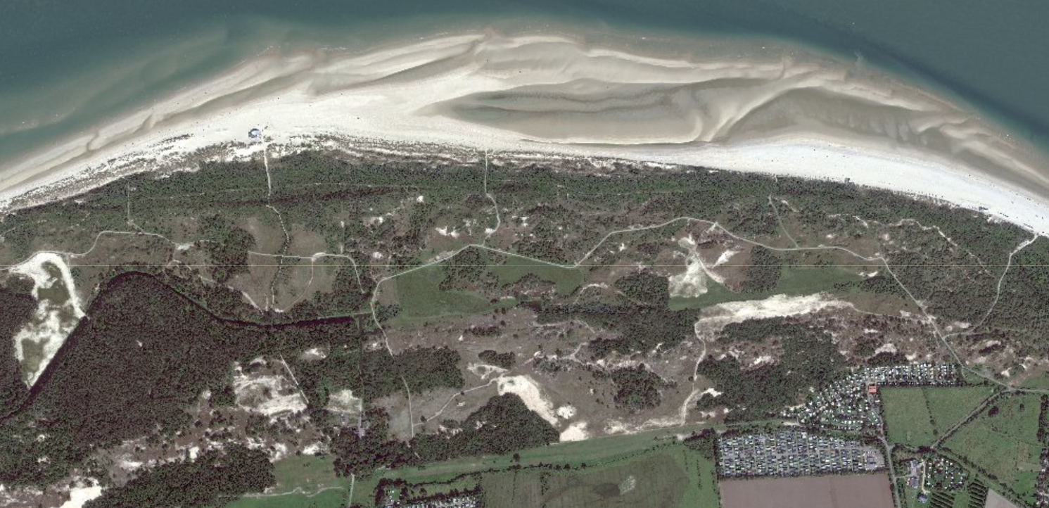
Dunes in Province of Zeeland. Source; Satellietdataportaal, Pleaides-Neo, 6th of September 2023.
Satellite data can play an important role in this. 'With satellites we can map different habitats from space, for example, observe heather overgrowth and determine herbaceous richness of grasslands,' says Jappe Jongejan, NSO satellite applications advisor. 'Yet satellite data are only sparsely used for this purpose. It turns out to be a big challenge to get from a good idea to an application for structural use.'
To increase and accelerate the use of satellite data by governments, the NSO uses the Small Business Innovation Research (SBIR) scheme. This is an innovation competition that challenges entrepreneurs to develop new products or services based on satellite data. In previous SBIR competitions, a government was the requesting party and companies could submit their ideas. This time participating companies were allowed to nominate their own government organisation as the end user.
Sixteen consortia submitted a proposal for this innovation competition. The jury chose four ideas, which, commissioned by the NSO, can further develop their idea:
Biodiversity in the blue-green zone
On the border between land and water it is notoriously difficult to map landscape elements. The Coöperatief Bomenregister and Landschap Erfgoed Utrecht are working with a project group consisting of water boards and provinces to develop an application that can examine precisely these riparian zones for their biodiversity value. This is important information for land managers, subsidy providers and the monitoring of the green-blue veining, among other things.
Desiccation in the dunes
Duinwacht is the name of an application that 52impact and Maastricht Sustainability Institute (part of Maastricht University) intend to develop together. Duinwacht provides information about historical and future desiccation of dune areas - and its impact on biodiversity. The Province of Zeeland, which manages many dune areas, is actively involved in the project.
Interactive ecology
Spheer.ai is developing an interactive app that will help monitor (natural) areas more efficiently and easily. The app uses the knowledge, experience and observations of ecologists in the field and artificial intelligence and machine learning to process, enrich and interpret data.
Measuring how dunes drift
Can you monitor the dynamics of sand drifts in dune areas with very high resolution satellite images?
That is the question in the Sand Tracer project. HKV is working on this with partners from the OBN Knowledge Network. They are using data fusion of satellite images and LiDAR height measurements, supported by artificial intelligence (AI). The goal is to use this innovative form of monitoring to gain insight into dune development along the entire coastline.
The feasibility study, which the four consortia are undertaking in the coming months, is the first phase of the SBIR. At the end of April 2024, the NSO expects the results, only to announce a month later which two consortia will be commissioned for phase two: develop and demonstrate a prototype.
New SBIRs
Biodiversity is a very broad topic, which several governments are working on. That is why there are SBIRs with different subtopics. The next one is the SBIR Satellite Data for Biodiversity in the Netherlands: sub-theme agriculture. There will be an information meeting about this SBIR at the NSO on December 13; companies with a good idea can register until January 23, 2024. Another SBIR will follow in 2024 with the subtheme water.
Funding for this innovation competition comes from the Ministry of Economic Affairs and Climate.
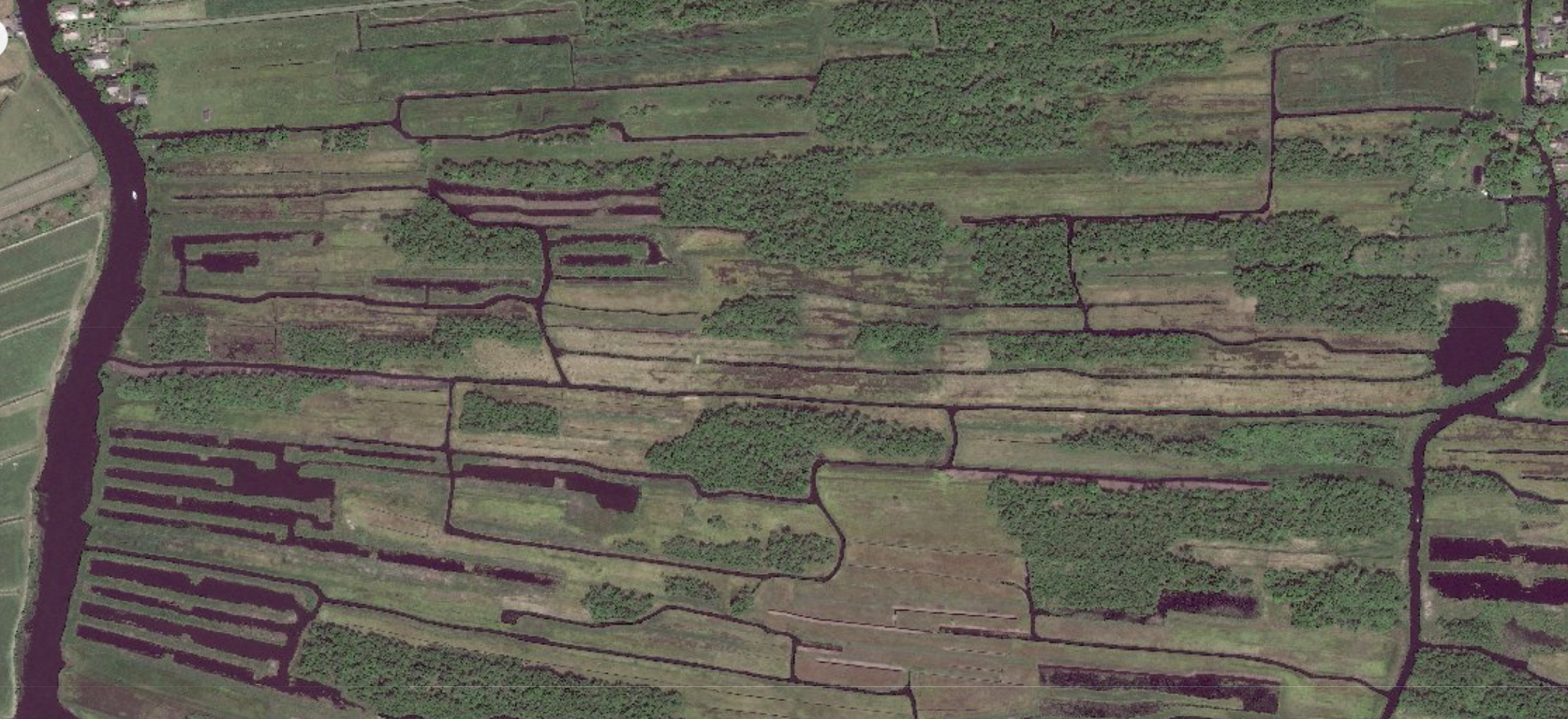
National Park Weeribben-Wieden. Source: Satellietdataportaal, Pleaides-Neo, 26th of May 2023.