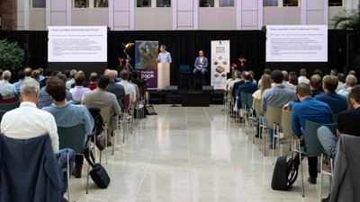
NSO and BZK network event: 'We should make the application of satellite data more mainstream'
How and where can we build? How do we deal with extreme precipitation and prevent droughts? How do we detect illegal logging? And where is room for what kind of agriculture? If we want to solve these and other societal challenges, data from space is indispensable. This became apparent during the network meeting 'View on the Netherlands, from space' last Wednesday at the NSO in The Hague.
About a hundred people were present, working for governments, water boards, knowledge institutions and industry. Exactly the mix of people that NSO director Harm van de Wetering would like to see: 'We need to better connect the worlds of developers and users, because the greatest importance of space is here on Earth, in solving challenges about mobility, agriculture, the built environment and more.'
Ruud van Rossem, program manager 'View on the Netherlands - data foundation' at the Ministry of the Interior, co-organizer of the meeting, agrees with this.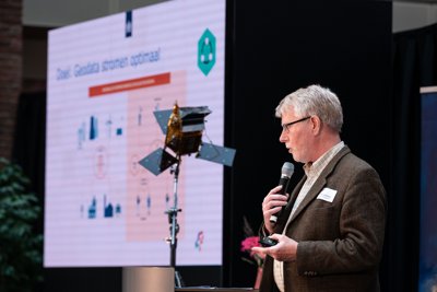
Ruud van Rossem presenting the program 'View on the Netherlands - data foundation'
The program sees geo-data as a foundation for making sensible spatial decision for the Netherlands. Much of this information is still being collected on Earth. Space can add a unique perspective to this: 'We are already working with satellite data in all kinds of ways in the Netherlands, but now this is done by a small leading group. We need to make space data more mainstream, and easier to use by a large group of people. This way you can make the data that is already available yield much better results.'
Satellite data and flooding
The broad applicability of satellite data is evident when people in the public use their smartphones to mention dozens of domains in which they see a role for space applications. The most frequently discussed - therefore projected largest on the TV screens - are: water safety, climate adaptation, crop protection, biodiversity, nature monitoring, heat stress and soil subsidence.
But how do you ensure that all these possibilities of satellite data are actually used? “We can play a role in that,” says Coco Antonissen on behalf of the NSO. 'During meetings like these we can discuss. What is already possible? But also: what questions is the government facing that currently have no solution? We have the network, knowledge and resources to support innovation processes and thus stimulate new applications of space data.'
One of these instruments, the SBIR scheme, was successfully used by the Steenbreek Foundation and the company Cobra Groeninzicht to gain insight into the 'imperviousness' of gardens in the Netherlands. Many tiles and bricks lead to greater heat stress and flooding. The municipality of Tilburg and the company Weather Impact also successfully participated in the SBIR scheme. They investigated where flooding can be expected in the event of extreme precipitation. The initiative has now grown into a public-private partnership between two companies and ten governments. Together they are working on an application that uses modeling and machine learning to calculate where water will end up on the streets after extreme precipitation for the whole of the Netherlands.
John van Smaalen (province of Gelderland) and Wigger Tims (NEO) presenting their project
Wigger Tims (NEO) and John van Smaalen (province of Gelderland) presented a smart satellite application that was partly created with data from the Satellite Data Portal. Van Smaalen: 'We heard that hedgerows were disappearing in our province. We then asked NEO if it was possible to map this with satellites. We now have maps with red spots at places where trees are disappearing. We can compare these locations with available logging reports. This makes the work of both licensing and enforcement a lot easier.'
Natalie Lorenz shows how the Municipality of Westland makes smart use of SkyGeo's subsidence maps. Partly based on this data, it is predicted where and when there is a high risk of flooding in the future. These insights allow the municipality to take the necessary measures now.
Ecology from space
Are satellite data currently being used sufficiently for Dutch society? The public voted via smartphone, resulting in a score of 3.5 (out of 10). So there is work to be done, even after the official presentations, during the informal drinks and information market. Maarten de Groot, present on behalf of SkyGeo, is looking for municipalities, water boards and engineering firms. Together with them, his company works on issues such as subsidence of foundations due to drought and detecting weak spots in Dutch dikes.
Jakko de Jong is looking for people interested in the field of nature monitoring. His company Spheer.ai combines satellite data and machine learning to scale the knowledge that is currently only available in the minds of ecologists. 'We teach the computer to look at nature like an ecologist. By combining artificial intelligence techniques with the enormous amount of satellite data available and the knowledge of ecologists, you can identify important trends much faster, better and more efficiently.'
During the drinks, end users can discuss their information needs with developers of new information products and services. Sometimes a single meeting is enough to spark a new idea – and make the application of space a little bit more mainstream.
Read further
The value of satellite data for social challenges (in Dutch)